Thursday, December 23, 2010

Chapter 14


Russia's biggest cities


Section 1
1.The area of the land that Russia covers is approximately 6.6 million square miles, or 17.1 million square kilometers.

2. Russia's natural resources are natural gas, mineral reserves, platinum, coal, nickel, gemstones, and aluminum.

creative writing: Many people are not aware that much of the world’s forest land lies on Russian soil. Actually, one fifth of all the world's forests is in Russia. these forests are populated by spruce, pine, fir and cedar trees, which are fit to survive through cold Russian winters. These trees also are second in the world for removing carbon dioxide from the atmosphere and replacing it with oxygen, the first place forest being the rain forests in the Amazon Basin in South America. The trees in the boreal, or most northern, forests of Russia also provide literally tons of the world's timber. But every year, 40 million acres are deforested for agriculture or livestock grazing or urbanization. The loss of these trees could mean the loss of that much oxygen in the air, and just that much more carbon dioxide to pollute it. Therefor, the protection of Russia's forests are as much important to the trees themselves as to the world.


Section 2
1. Russia's main climates are tundra, steppe, humid continental, highland, and subarctic.


Average annual temperature in Russia.

2. In the tundra region of Russia, there are no trees, but wide, frozen planes. In Russia's subarctic regions, coniferous forests dominate the landscape, while in the humid continental regions, coniferous forests mix with deciduous forests. in the steppe climate of Russia, many plants grow, including sunflowers, mint, and beans, and vast expanses of grassy planes.

creative writing: If I were a member of Napoleon's army invading Russia in 1812, this journal entry might describe what my day would have been like:

December 14, 1812
   We walked another full day, today. The snow kept falling, and we kept walking, and the men in my regiment kept falling over, for they couldn't feel their feet. The Russians, as they retreat, kept burning their own towns. Sometimes the houses and barns were still on fire when we reached them, and we walked across the hot ashes to relieve the cold in our feet and legs. Napoleon told us to search the ruins for food or supplies, even though we knew it was futile. I only found a dead lamb. The other soldiers wanted to eat it strait away, but as it was about to be cleaned, the smell of rot came out from it, and we went hungry again. My dear friend Pierre died from pneumonia, and I pray that he is well, wherever he is. I also pray that i make it home without losing any more than the toes that froze today.
-- Théo Abbe

Sunday, December 12, 2010

Chapter 13


Section 1
1. Three of the reasons major economic changes are taking place in Europe are the opening of tourism in urban areas, the fall of communism, and the creation and expansion of the European Union, or the EU.

2. Some changes in the economies, farming techniques, and communications in eastern Europe since the fall of communism in 1989 are the switching from command economies to market economies, the use of organic farming, and the merging of Eurovision and Intervision broadcast networks to create the European Broadcasting Union.


The euro is the most common form of currency in Europe, as it is used by most countries in the EU.
 creative writing: As Europe develops a more unified, service-oriented economy, a question rises: is it more important for nations to develop more efficient communications systems than to develop more efficient transportation systems? I believe that both are equally important. More efficient transportation would mean that less oil is used to power trains, cars, boats and airplanes. Also, a more efficient communications network would mean that more people could share their ideas with the rest of the world through fiber-optics, cell phones, satellite relay, cable and microwave relay. This would especially help communications in eastern Europe.

Section 2
1. Three ways the industry and farming practices have affected Europe's environment are soil erosion caused by over-farming, over-grazing, bad farming practices and too much removal of vegetation, the deforestation of nearly two-thirds of the natural forests of europe, and the creation of acid rain by the mixing of moisture and air-borne chemicals produced by factories and industrial sites. 


Trees killed by acid rain in Europe.


2. The steps that have been taken by the European Union to protect Europe's environment are the burning of natural gas instead of fossil fuels, the use of Biogas, a gas made by decomposing organic materials, and the law that states that by this year, 2010, all countries in the EU must have lowered their emissions to 15% lower than their previous levels in 1990.

creative writing: Are the pollution laws and controls put in place by members of the European Union all that is necessary to protect the environment in Europe today and in the future? In my opinion, no. I believe that we are always needing new restrictions to erase or at least lessen our environmental footprint. As long as humans will need electric power, we will need restrictions on our uses of it, and even the most recent laws against greater pollution will become outdated.

EU-flag
The flag of the European Union.

Sunday, December 5, 2010

Chapter 12


Map of Northern Europe


Section 1
1. Over the past 100 years, immigration has influenced populations of countries in northern Europe by increasing the density of the population to 60 million people in approximately 94,488 square miles of land, and changing rural areas into urban cities.

2. The physical geography helped shape the population patterns of Northern Europe because both the islands and peninsulas that make up Northern Europe's countries are accessible to oceans and seas on most sides, allowing .peoples in the past to invade, conquer,  inhabit, and form these countries.

creative writing: There are advantages and disadvantages to living in a country that is a welfare state. The advantages are not having to worry about paying for tuition, health-care, retirement benefits, unemployment benefits, etc. But the disadvantages are that all of these is paid for by public taxes, and the benefits are equal to everyone, poor or wealthy, and the wealthier cannot buy extra benefits for themselves or their family.


Political map of Europe
Map of Western Europe


Section 2
1. Three ways that a religion has helped shaped the history and governments of western Europe are by creating  rivalries of power between nobles, emperors and popes and church officials, bringing about the Thirty Years' War, and sparking the holocaust during World War II.

2. World War II helped shape population patterns of western Europe because it meant that millions of people were  being moved, killed, or evacuated. Also, after the war, Germany was split into two separate countries before the fall of the Soviet Union: West and East Germany.

creative writing: The people of western Europe have a high standard of living, and governments provide citizens with medical care, maternity and retirement benefits, and other services, but the population in Western Europe is aging, with declining birthrates and death rates. In the next twenty-five years, many problems may surface. the population may reach a state where there are not enough citizens that are capable of working, and the number of working people will drop, along with the economy. this also means that with an aging population, there will be a narrower selection for national sports teams, and less people able to play.


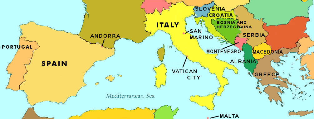
Map of Southern Europe

Section 3
1. Because most Southern European countries are experiencing a period of immigration, urbanization is common, as most immigrants move to larger cities to find better jobs, and the population density is rising more quickly.

2. Three cultural elements shared by most of the people in Southern Europe are literacy, a knack for modern art, and the speaking of romantic languages.

creative writing: The Roman Empire ruled most of southern and western Europe, along with some of Asia and Africa. they left behind traces of their culture in the modern Europe we know today. we see it in the domes, columns, and arches in modern architecture, in the romantic languages spoken in Europe and the roots of the English language, and in the Roman Catholic Church.

Sunday, November 28, 2010

Chapter 11


Map of Europe
 

Section 1
1. Many natural forces sculpt Europe's land formations. One example of a glaciation-affected land form is Ben Nevis. An example of a land form affected by wind is Northern European Plain. A third example, of land forms shaped by tectonic or volcanic activity would be the Pyrenees Mountains.

2. Rivers are vital to Europe's economy because they act as trade ways that allow vessels and cargo ships to travel into Europe's interior, with the aid of canals.


map of Rhine River
 creative writing: There are many economical and political disputes about and over the Rhine River, which flows through three countries from its source in the Swiss Alps, along part of the border between France and Germany, through Germany for most of its length, to its final destination in the North Sea off the Netherlands. First of all, as both an economic and political issue, both Germany and France share a border formed by the Rhine. This river is disputed over because of the confusion of whether that certain stretch is owned by France or Germany, and whether or not either country can modify the river with the creation of dams or canals. secondly, if any country does dam the river, its flow into the Netherlands will be greatly reduced, and travel up and downstream will be affected. And a third challenge that the countries along the Rhine River face is the pollution that is produced from industries along the river. If a stretch of river close to its source is contaminated, then the rest of the river will be too.


map of Europe's average temp.
 Section 2 1. The major influences on climate in Europe are latitude, wind, land forms and ocean currents.

2. Winds affect the climate regions of Europe by bringing warm, moist air from the waters in the Gulf Stream and the North Atlantic Current into western Europe.

creative writing: The city of Dublin, Ireland, is at about 53° N latitude, and has an average January high temperature of about 44° F (about 6.6° C). The city of Duluth, Minnesota, is at about 48° N latitude, and has an average January high temperature of about 16° F (about –8.88° C). the reason for the higher average temperature is because the warm winds that blow off the Gulf Stream and North Atlantic Current keep the air i western Europe from becoming colder, while Minnesota, having so such winds, becomes much colder in the winter.

Saturday, November 13, 2010

Chapter 10

Section 1
1. The basis of the economies in many Latin American countries is agriculture.


Gross Domestic Product (GDP) in Latin America

2. The causes of Latin America's economically dependent status are the abundance of cash crops that are sold as exports. The consequences of this dependence are an extreme economic crash, should anything happen to the crops or the latifundas they are grown on.

creative writing: The North American Free Trade Agreement, or NAFTA, is the agreement that gradually, trade restrictions will be decreased, and the flow if people, goods and services will be increased. There are advantages and disadvantages to NAFTA. One of the advantages is that trade between Canada, Mexico and the United States in creased by 10-15% every year, but a disadvantage was that it affected the overall effects on gross domestic product and regional employment very little.


section 2
1. As more and more people move into Latin American cities and towns, more and more housing, farming and work developments are made to keep up with the growing population, which takes up space. This space usually comes from the rain forest, and in using this space, we are depleting the natural resources there.

population growth in Latin America


2. The challenges posed by the growth of Latin America's urban population are the lack of safe housing, the unsanitary conditions of shantytowns, environmental laws that ban a certain amount of expansion, industrial pollution that both destroys the rain forests and beaches and waterways in Latin America, but also smog up the cities.

creative writing: The countries of Latin America are facing many challenges of regional and international significance. Two of the biggest issues are being in balance with the environment, and their economies. In Latin America, most of the wilderness is either beaches and ocean, or tropical rain forest. Much of the resources that powers industries such as fishing and logging are dependent on the ocean waters and the rain forests, but if these locations are changed in any way,  then the ecosystems of that environment would be destroyed and the fish or wood, per say, would no longer be available. in the Latin American economies, much of the money lies on agriculture. But if there were a disease that killed off most of the produce or live stock grown on the farms, then the economy would crash because the product would no longer be available. Another larger part of the economy is industry. but most people who work in factories or farms do not make very much money, and because of increased industrialization, many companies are replacing workers with machines, raising the number of jobless people in Latin America.

Slash-and-burn farming is used to clear rain forest land and make it suitable for farming.


Chapter 9

sorry, no homework :) :P

Sunday, October 31, 2010

Chapter 8

Section 1
1. Geographers divide the large region of Latin America into three sub regions: Middle America (the areas between Panama and Mexico), South America, and the Caribbean.

2. The natural resources that make Latin America an economically important region are natural gas, oil deposits, mineral deposits such as gold, copper, aluminum, silver, and even emerald gems.

creative writing: The water systems of Latin America are necessary for trade and transportation. As the second longest river in the world, the amazon river winds its way through the rain forests of South America, leading fishermen and traders across the continent. the Paraná, Uruguay, and Paraguay Rivers all flow together and form the second largest river system on the continent. theses rivers also provide transportation and trade routs, and also give a source of hydroelectric power, electricity created by the movement of water through a dam. the Panama Canal, in Middle America, is a man-made canal that allows ships and boats to cross between the Atlantic and Pacific Oceans without having to go all the way around the southern-most tip of South America.
 
South America's river systems

section 2
1. The climate regions of Latin America are tropical wet and dry, steppe, desert, Mediterranean, humid subtropical, marine west coast, and highland.

2. The highland climates, which are affected by location and altitude, occur mostly in the Andes Mountians in South America. Geographers call the differences in climate and vegitation vertical climate zones, and these zones are classified as tierra helada (above 16,000 ft, snow and ice, less than 20˚F), puna (between 12,000 and 16,000 ft, grass but no trees, 20-55˚F), tierra fría (between 6,000 and 12,000 ft, greatly spaced evergreen trees and shrubs, 55-65˚F), tierra templada (between 2,500 and 6,000 ft, broad leafed and pine trees, 65-75˚F), and tierra caliente (between sea level and 2,500 ft, coastal areas and foothills with a few trees, 75-80˚F).

creative writing: If I were to hike through the tierra fría in South America, this might be similar to a journal entry about what I would see:

    Day 1
   I took a gondola up the side of the mountain this morning. The fog was cold, and I'm glad that I brought a thick jacket. I couldn't see much of the mountian, but when i got off, there were a few trees nearby. There was frost on the ground as I set out across the mountain. I passed some farmers with thier sheep. They were friendly, but I dont think they wanted me near the animals. The fog cleared up around noon and I finally saw the landscape around me. The long green grass was wet with dew, and the few trees that grew here were dark, tiny dots on the mountain sides. It was amazing! I was so buisy looking around that I didn't see the tree in front of me and I ran right into it!

   Day 2
   After setting up camp yesterday, I couldn't sleep, so I watched the sky. There were so many stars, so much unlike in the cities below me, but most were hidden by passing clouds. When I was in my tent, I could hear the sheep bahing from across the mountain. this morning, the ground was covered in frost, and it got my boots wet and cold as I continued to hike. I met more farmers, but they tended crops of potatoes and barley instead of sheep. It was still cold, but i was warm from walking. a small stream was falling down between some rocks on the ground, and I had to walk across it, because it was too wide to jump. I almost slipped on the rocks, and the freezing cold water got in my boots, making my feet even colder than before.

   Day 3
   It was my last day in the tierra fría today. As I made my way back to the gondola station, I crossed the stream again. I was more careful about where I stepped, and I carried my shoes and socks instead of wearing them, so I could dry off my bare feet and put on warm shoes. You could say that I learned my lesson the hard way yesterday. The thick shrubs that clustered in the grass rustled when the wind blew, and some needles fell off the pine trees, too. The frost wasn't as common as yesterday, as the clouds were gone all morning. The bright sun hurt my eyes, which had been adjusted to the overcast sky. When I reached the station, I took a last look around. The view still stunned me, and I remembered the camera in my backpack. I took it out and snapped a quick picture before getting on the gondola.


tierra fria, bosques oscuros, bosques de montañas, montañas con neblina
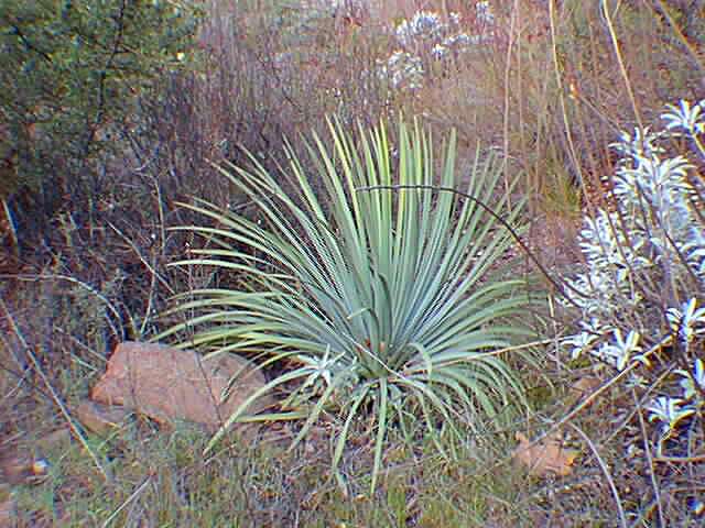
vegitation in the tierra fría

Sunday, October 24, 2010

Chapter 7


section 1
1. The development of a postindustrial economy in the United States and Canada are affected where and how people live because a postindustrial economy is based on service and high-tech industries. Service is the largest part of postindustrial economies. it includes government jobs, and also educational, health care, and banking jobs, and these depend on people living near their job sites, and people being able to do their jobs regularly. High-tech businesses depend on access to natural resources and transportation. places like Silicon Valley in California, are home grounds for major high-tech companies like Apple and Microsoft. for people to live there comfortably, and to keep them to stay, these cities offer pleasant weather - most of the time - and nearby housing as well as many jobs.


2.The economies of the United States and Canada are interdependent with each other and with those in other parts of the world because of a lack of some important natural resources. While some countries might have a certain kind of resource, like coal, another country might have iron.

creative writing: All around the world, different countries have different economies, and some even have multiple economies at the same time. Canada and the United States both have a market economy, which allows people to profit, own, and operate their own business. It also allows employers to pay their employees for their work and it holds laws and rules that defend employment opportunities, safety and health of workers, and private property rights. A postindustrial economy is transformed when technology develops in workplaces. The U.S. also have a postindustrial economy. A global economy is affected by trade all around the world. when a certain country spends money on imports, and earns money on exports, or when a country or region stop spending money or stop earning money, the global economy expands or shrinks. These three types of economies are interrelated because what a country exports affects what it can buy; what it can buy affects what it creates; what it creates affects what kind and how many jobs there are; those jobs affect who can work and how much the employees are paid; and the products that are sold, and the money that is earned affects how many people will buy the end product, which is all part of the global economy, postindustrial economy, and market economy.


section 2
1.One of the ways that the United States and Canada could manage their natural resources more responsibly is to stop clear-cutting forests, and instead cut some trees away, and replace them with native trees, then let the trees and plants grow back while harvesting another small part of the forest. Another way is to replace driving with other means of transportation (such as walking or bicycling), or to use public transportation (like buses or trains) to get from one place to another without using individual vehicles. A third way would be to eat less. It would mean that there would be more agricultural products to go around, a drop in over-fishing, and less production of greenhouse gasses used to process the food in mills and factories.

2.There are many forms of pollution in the United States and in Canada. One form is acid rain, which caused when chemical emissions released by factories, cars and power plants mix with water in the atmosphere and fall down as highly acidic rain. This rain can threaten timber and water resources for hundreds of miles from where their clouds first formed. Another form of pollution is smog. Smog is formed when sunlight meets with exhaust and chemical emissions to form a thick gray-brown cloud that hangs low over the ground. A third type of pollution is water pollution. water pollution damages water systems such as lakes, rivers and even oceans. Eutrophication, the process in which water becomes richly dissolved in nutrients speeds up with water pollution, which allows algae and bacteria to grow extremely quickly, leaving no oxygen for the fish and other animals that live in the polluted  waters.
(top) clear day in Denver, Colorado
(bottom) smoggy day in Denver, Colorado


creative writing: If the Trans-Alaska Pipeline were to touch the permafrost - a frozen water and soil layer that lies underground - and melt it, the sold mud and water could rust the piping and cause it to leak, spilling crude oil across thousands of miles of wilderness and ruining ecosystems all around it, or the supports for the pipes could slip in the now liquefied ground and create the same disaster.

layers  under the top soil in Alaska and northern Canada

Sunday, October 17, 2010

Chapter 6

U.S.A. national
Section 1
1.Industry and technology supply jobs, and people looking for work go where there is a big demand for workers will go where they have the best chance at getting a job, and they bring their families with them. People will also avoid living in an area that is too hot, too cold, too wet, or too dry, and prefer to be in an area with a mild climate such as the west coast or the northeastern seaboard.

2. Four cultural elements influenced by the immigrant roots of the United States are language, religion, music, and education.

creative writing: All throughout United States history, there have been immigrants and settlers coming to escape discrimination, seek freedom, or a better economy. These next paragraphs might tell what life was like for a young female settler in 1845 coming to the United States for the first time, and her life afterwards.
  As she comes into New York Harbor, Charline is pushed back and forth between men and women and children, all from countries other than hers, as they rush to the vessel's windows for a view of the shoreline. Clutching her husband's arm, the twenty-year-old woman goes with the cround onto the top deck, in hopes of seeing their year-long destination, Ellis Island. When the ferry docks in the shadow of the enormous Ellis Island Immigration Building, and the ferrymen set up the plank, a steady stream of people sets foot onto solid American ground. Tears and a smile erupt on Charline's face, as well as her husband's. They wait long, cruelly anxious hours in line for their medical examination, immigrant papers, work grants and finally, finally, they meet again on the last stairwell of the building. They've made it. but many others were not as lucky. Broken families weep as their loved ones are kept inside for reasons sometimes not understood - diseases identified by speciallist doctors, a violent record back home, or not enough money on hand. The young couple feels sudenly guilty for the smiles on their faces, but they rush past the crying and mourning people to join the next ferry to the main land, to New York.
  Years past, and Charline, thirty and a mother of four children, lives with her husband in Detroit. the flour mill allows both male and female workers, and so while charline and her husband work, their neighbors, and close friends watch their chldren as well as their own. After four years of savings, and when their eldest three children are working, and the youngest is in college on a schollarship, Charline and her husband decide to move to California to join the Gold Rush. Unfortunately, when they get there a year later on covered wagons, all of the easy gold is gone. But the ecconomy is cheaper, and they decide to stay. While Charline becomes a seamstress, and her husband a banker, and their income is steady, taxes are high, because of the Civil War. 
  Charline was aging from stress. Both of her sons had joined the union army, one, who had a wife and child, had quit his job at a quarry, and the other had dropped out of law school. Her daughters stayed out of fighting, but one confided through a letter that she was a nurse at one of the union camps. When the war subsided, Charline, 40, would pace restlessly, awaiting her children's letters of how they, had survied the war, or how they had saved the lives of countless men, or something great. Only two of her children sent those letters. As greif filled her heart at the loss of her youngest child, Charline lived her life monocramatically. When she fell ill at age seventy, in the year 1895, she cried for her son, and when she lay on her deathbed, surrounded by her frail husband, and her surviving children, she smiled, for she would see him once again. She would see her old country, her childhood friends, her Detriot friends, her family.

Canada's national flag

Section 2
1. Two economical factors that encouraged the growth of Canada's western population are the aquiring of land from the Atlantic to the Pacific, and from the arctic to the United States, and also when gold was discovered in the Klondike province, sparking the Klondike Gold Rush.

2. Canada's religious practices and languages reflect the immigrant history of the county because the languages spoken by the provinces of the country are French and English, which reflect the stuggle between Great Britain settlers, and French settlers, and six main religions make up most of Canada's population, and all of them come from all around the world.

creative writing: If the american colonies had not separated from great britain, then canada would have become a French country, and would be much smaller, population wise, because one million British people would not have immigrated to Canada.

Saturday, October 9, 2010

Chapter Five

Section 1
1. The lakes and river systems in the United States and Canada supply North America with drinking water, transportation of people and goods, as well as providing hydroelectric power through the use of dams. The mountain ranges on both the western and eastern sides of the continent decides which direction the rivers flow. The Continental Divide, a ridge or high point in the rocky mountains that directs the rivers to flow into the pacific ocean. The Fall Line, in the Appalachian Mountains, is the ridge that directs the eastern seaboard's rivers to flow out toward the gulfs, and the oceans, and away from the center of the continent.


the rivers of North America

2. Some of the major geographical features and natural resources that played important roles in the economic development of Canada and the united states are forests with desirable woods, coal, natural gas, fossil fuels, petroleum and minerals such as gold, silver, iron, copper and potash - a mineral salt.


creative writing: If I were on a non-stop flight from Norfolk, Virginia, to Seattle, Washington, and the airplane was low enough that I could easily see the ground through the window, I would be able to see all the landforms in between these two cities. The first thing I would see would be the Piedmont, a wide area of both high and low rolling hills. Next would be the old, green and sloping Appalachian Mountains, and after those, I would see the snaking Ohio River. Then the airplane would fly over the Great Planes, which would stretch for miles around, criss-crossed by the Mississippi and Missouri rivers. Then I would be flying over the Black Hills, a small mountain range of dark rock and wooded slopes, before going over the sharp grey points of the Rocky Mountains. Last of all would be the Columbia and snake rivers, both of them fast and cold from rain and snow melt.


Section 2
1. The types climate regions found in Canada and  the United States are subtropical, tropical, desert, and Mediterranean.


2. Three of the weather-related hazards found n the United States and Canada are hurricanes (huge tropical storms with winds of at least 75 mph), supercells (violent storms that often sprout tornadoes), and blizzards (snow storms with winds of at least 35 mph).


creative writing: The land forms surrounding an area and the area's elevation determine its climate. Two places of similar latitudes like Salt Lake City, Utah (40.45º N) and Philadelphia, Pennsylvania (40.0º N) have very different climates because of these variables. Salt Lake City is 4,226 feet above sea level, and Philadelphia is 45 feet above sea level, which means that Salt Lake City is moss likely to be colder than Philadelphia. Salt Lake City is also a steppe climate, which means that it receives little rain and is hot in the summer and cold in the winter, while Philadelphia is in a humid subtropical climate which means that it receives a lot of rain, but has mild winters and muggy summers.

Sunday, October 3, 2010

Chapter Four


Section 2
1.  A culture can be defined by economy, daily life, history, language, art, religion and government.

2. The development of agriculture, language, trade and travel have all affected the interaction between cultures in recent years.

creative writing: If the informational revolution had not occurred, and there were no computers, no Internet, and no personal information storage devises, everyone's lives would be very different.
When I wake up, I would dress like I usually do. I'd come down stairs and eat my breakfast, brush my teeth and make my lunch. As my mom drives me to school, there are buildings, houses and parking lots, but no printed signs stating ; "Vote so-and-so for sheriff" or "Elect this person to be legislator." As we pull up to the school, the electric announcement board isn't there. In its place is a plastic sign with arrangeable letters. In abbreviated words it tells what is happening that week at school. A bell is rung, manually, and it keeps ringing for a minute. A cold wind blows dark clouds over head as I walk to the class room, and I wish that I'd brought a jacket. But no one else had brought one either, because there is no radar or weather man to tell us his weather predictions. during class, the teacher draws a picture of how our paper should look on the white board in front of us. We take out pieces of paper and recreate the drawing on our paper with pens and pencils. reading the single, handwritten book aloud, the class listening intently, for we have no books of our own because there are no printers to make any for us. When the last bell rings, I take home my notes on the homework, and my half completed pages. my brother is taken to his soccer practice, and my dad comes home from work. I finish my work, eat dinner, brush my teeth, and go to bed. no television, no computers, no cell phones, and no iPods. That would be my life with out the information revolution.

Section 3
1. The differences between major types of governments is who runs the government. this is divided into three main groups: (1) autocracy- run by a single person -, (2)oligarchy - run by a few people, usually wealthy ones -, and (3)democracy - run by many with representatives for all people.


2. Some examples of major types of ecosystems on the world are traditional, command, and market.


creative writing: In the scenario that I live under a democratic government and in a market economy, there would be both advantages, and disadvantages. the advantages would be that civilians would be able to vote for themselves, elect who they want to become government officials, and they would be able to buy what they want, sell what they want, and make as much of their product as they want, without too much interference on the government's part. the disadvantages, though, would be the fact that democracies go by the majority, and sometimes not everyone is satisfied in the end, and also, there is some government involvement when dealing with business.


United States' three branches of government


Section 4
1. A major factor in determining a country's economic development and trade relationships is how many natural resources that country has.

2. Human economic activities have, in recent years, had drastically affected the environment by introducing pollutants such as  carbon dioxide, carbon monoxide, plastics, and scrap metals. and as cities become wealthier and become larger, they take over precious ecosystems that house plants and animals dependant on that specific environment.

creative writing: I disagree strongly with the statement, “Only developed countries need to replace their dependence on fossil fuels with the use of renewable energy resources.” I believe that if we are going to save our planet, we have to do so as a whole. if only the most developed countries reserve to renewable energy, that still leaves half the planet to use fossil fuels. to save our precious environment from total destruction, every country has to help, and every person has to help.

Sunday, September 26, 2010

Chapter 3

Section 1
1. Earth's distance from the sun, approximately 93 million miles, is ideal. It allows for plants to grow, but also for water to freeze. Direct sunlight can heat the ground to over 100 degrees Fahrenheit, but indirect light fragments off the ground, reducing the heat generated.


2. Due to global warming, Earth's air will become hot and humid. Earth's polar ice caps will melt, swelling oceans and rivers that connect to them, destroying most of earth's coastal cities. Cold climate plants will die out, along with cold climate animals such as polar bears, penguins, seals, caribou, and arctic wolves. This leaves an opportunity for warmer climate plants and animals to grow in size and population.


the world's average temperatures

creative writing: I believe that global warming is a natural occurrence, but humans do have some part in it. I think that if we had been more environmentally aware, we could have lessened the severity of the effects, or at least slowed down the process. Global warming occurs in between two ice ages, as some scientists believe, and that in the next thousand years, another ice age will begin, but in the meantime, the weather will continue to get hotter, the icecaps will continue to melt. I think that as a planet, if everyone did something, whether it be riding a bicycle instead of driving a car everywhere, or conserving water, or recycling paper, glass, plastic and metal instead of making new products, then we can make a difference in our future.

Section 2
1. Latitude and elevation can affect climate. The farther away you are from the equator, the cooler the weather gets. The equator is usually closest to the sun, and is always warm, but if you travel farther north or south, then you are travelling out of direct sunlight and therefor, the ground, air and water are all colder. Elevation is different. the farther up above sea level that you are, the thinner the atmosphere, and therefor, the colder the atmosphere. earth's atmosphere holds and regulates temperature. But since the atmosphere is thinner, the atmosphere cannot retain the heat of the sun and the weather is colder. If you go lower down, below sea level, the hotter it is, because the atmosphere is thicker, and absorbes more heat.
the world's currents

2. Wind patterns can bring reliving rain to a dry inland landscape by blowing rain clouds in from the oceans. Ocean currents can bring a decrease or an increase of temperature depending on where they started, and where they end up. The gulf stream, for example, brings warm water from the Caribbean Sea and the Gulf of Mexico all the way up to Britain and the UK. land forms, like mountains can block rain clouds from reaching the area beyond, creating a desert plane. Mountains also receive more rain and snow because of their height, temperature, and atmosphere.

creative writing: It would be an environmental disaster if the  North Atlantic Current came to a permanent stop. The North Atlantic Current is an extension of the Gulf Stream, and brings warm water to northern Europe, and Greenland, which keeps these places from completely freezing over in the winter. The current also keeps the oceans from becoming like the northern polar region - that is, frozen almost completely and difficult to retain life. if the current were to stop, however, all of these things would come true. The northern countries of Europe - Great Britain, Ireland, Sweden, Norway, Finland, and parts of Russia would become frozen and would take on an Arctic aspect.

section 3
1. Geographers classify climate regions into five classes: highland, high latitude, mid latitude, dry, and tropical regions.

2. Recurring phenomena, such as El Nino and La Nina, can affect different climates in different ways. El Nino, which is the warming of the pacific ocean, creates rainstorms and floods all along the pacific coast, disrupting the food chains of birds, fish and sea mammals, and also by lessening hurricanes in the Atlantic. La Nina, is just the opposite. It is created by the cooling of the pacific ocean, and makes rain and snow along the pacific coast, drought in the southwest of the American continents, cold weather in Alaska and Canada, hot weather in the rest of the USA and Mexico, and more hurricanes in the Atlantic.

creative writing: In Huntington Beach, which is a dry, coastal desert region, rain is rare, and temperatures usually remain in the 60's to the high 80's. Sea breezes are daily occurrences, and land breezes are nightly ones. The natural vegetation here are cacti and succulents, woody bushes and shrubs, and short growing trees. The natural soil is full of hard clay and sand, and is mostly barren.

Southern California's natural vegetation


Friday, September 17, 2010

Chapter 2

Section 1
1. landforms and oceans are the largest natural features on the earth's surface. the seven largest landforms on Earth's surface are the continents (Africa, Asia, Australia, Antarctica, Europe, South America, North America). these continents yield a variety of features:
 rivers - moving bodies of water that move down hill, pulled by gravity, usually fed by rain water, snow melt, or a lake
 lakes - a large body of still water that rests inland,
 desert - a large, dry area that receives little to no liquid water in the form of rain,
 seacoasts - land lying next to a sea or ocean,
 glacier - a large, wide, and thick body of ice that slowly moves, carving out vallies,
 mountains - a peice of land with sweeped sides that rises sharply from surrounding land (usually more than 1,000 ft),
 volcano - mountain or hill created as liquid rock and ash erupt from inside the earth's crust.
oceans are large bodies of salt water that cover over 70% of the earth's surface.

2. The point on Earth's surface that is the greatest distance from sea level is Mount Everest (29,028 feet, 8,848 m).

creative writing: I believe that when small objects such as meteorites or comets enter earth's atmosphere, they have no long-term affect on the lithosphere, atmosphere, or biosphere. I say this because the smaller objects are usually burned off in the outer layers of the atmosphere, and usually don't reach the biosphere or lithosphere, and the the earth's gravity pulls the dust toward the earth and it becomes soil.

Section 2
1. the Earth's layers create movement within the  mantle (the layer of molten rock just under the earth's top layer, the crust), which in turn, move the plates on the earth's crust. This creates mountain ranges, volcanoes, hot spot islands like Hawaii, fault lines, and folds in the crust. the solid inner core of the earth, made of iron and nickel, spins faster than the rest of the earth, and creates the magnetic field that protects us from the sun's harmful solar wind.

2. The movement of magma - liquid rock and metal -  in the earth's mantle creates continental drift that forces the continents and the plates under the oceans to move. this move is very slow (sometimes less than and inch a year), but progressive. For it was this force that moved our continents out of the singular, mega continent, Pangaea, into the seven that we know today. the external forces that shape our continents are rivers, wind, and glaciers. The rivers pick up silt and rock and dirt when they move, and deposit them farther downtsream, creating banks and canyons. this process is called erosion. Erosion is how the Grand Canyon was formed. Wind can pick up sand, dust and dirt and scrape them into dunes and hills. This activity is most common in a desert. glaciers move perhaps the slowest of all (inches a year), but do the most work. they scrape out valleys and  wear down mountains.


creative writing: the internal forces of the earth have changed the surface of North America over the past 225 million years.
when the continents were one, continental drift was beginning to pull them apart. 200 million years ago, the continents were just barely touching. they were only connected by thinning isthmuses (thin pieces of land connecting larger pieces of land). 65 million years ago, the continents were almost in place. they were spreading out over the globe. North America, surrounded by six different tectonic plates, was pushed, bumped and squished into the place it is today. the rocky mountains, running up and down the western side of the plate, were formed from the movement of the North American plate and the Pacific plate. the San Andreas fault, running along the west coast, goes right through many southern and central California towns.

Saturday, September 11, 2010

first assignment!

chapter one, section one
1. Two concerns that cartographers have when choosing map projections are the size proportion of the land masses and oceans, and the distance between places on the map.
2. Two physical features seen on an urban area map might be a beach, and a river. Two man made features would be a freeway and an office building. two political features seen on a map might be a capitol building and a political monument.
ceative writing: if i were a city planner in a growing urban city, and i had to choose locations for new elementary schools, i would look out for any hazards to young children. the information that i would need to choose a safe location would be: if there were any busy streets of intersections nearby, or if there were any developing neighborhoods nearby (new families with young children).
There would be numerous features on a map of an urban area. The physical features would probably include any rivers, hills, lakes or ponds nearby. These would be important when choosing safe places for an elementary school, because they can be hazards to younger children. the human made features that would be shown on a map would be sub-urban neighborhoods, streets, freeways, buildings, and abandoned structures.
these could also be dangers if near a school. Lastly, the political features would be police buildings, fire houses, hospitals, and the capitol buildings in the city. these would be essential should there be an emergency at the school, and it would be helpful if they were in close proximity.

chapter one, section two
1. The major branches of geography are region(weather, average temperatures), human-environment interaction(use of resources, pollution), political(governments, economy), site(in relation to other cities, countries), and location(where a certain place is in the world).
2. Geography is used to study the earth, its features, the plants and animals that live here, and the things that happen in different areas of the world, and how they affect life there.
creative writing:  In Huntington Beach, in southern California, we live in a hot, dry coastal desert. with a drought upon us, many of  us do our best to conserve energy, whether it be water, or electricity, or oil. While living above the solstice of cancer does little to cool down the hot summer months, many still conserve water (I turn off the sink when I brush my teeth), although we have plenty of it! the ocean is right in our backyard, and we use it! the beach is always a popular spot during spring, summer and early fall, but not all is well in the swells. trash is sprinkled along the sand and parking lots along the coastline, yet another issue with the environment. although monthly beach clean-ups are held throughout the year, its still important to make sure everything gets into the trash cans!
  People immigrate to California from all over the world. in the 1900's, Asian immigrants came into our country through San Fransisco, people from Africa, Asia, Europe and immigrants from Mexico still come in today. this has a great impact on the culture of Huntington beach. everybody knows somebody from a different background and ethnicity, somebody who is different from themselves.with so many people, we have many view points and opinions, about ourselves as a whole, as individuals, and as a species in an endangered environment.
Here in HB, living next to the ocean is a large part of human-environment interaction!

Thursday, September 9, 2010